Date last visited: March 25, 2005
Agency: Tualatin Hills Parks and Recreation District
Path Surface: Mostly paved
Elevation gain/loss: Rolling hills
Distance: Variable, 3-3.5 miles
Ratings: Setting +++ (for the views) Calorie-burning ++
Directions: From Murray Blvd in Beaverton, turn west on Beard Rd. If driving, park near SW 158th and walk west, road narrows at this point with no room for parking. Look for a pole with orange and white tape marking the dirt path. N 45º 26.86 W 122º 50.33
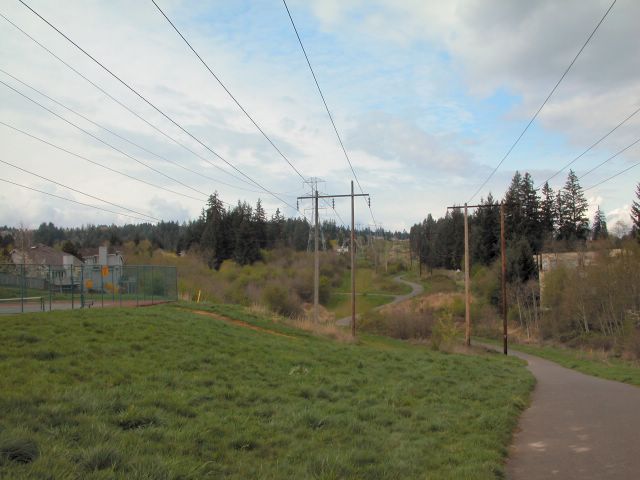
A holly orchard, great views and rolling hills make this walk unique. From Beard Rd, passing a small pond, the dirt trail climbs almost immediately to SW 160th. On your way up, watch for scrub jays, cedar waxwings, robins, song sparrows and flickers. Look back here for your first view of the West Hills. After crossing the street, pick up the paved path, or this may be an alternate starting point, especially for walkers with strollers. Neat rows of holly trees branch from the path, giving way to a wide open view of Mt. Scott, and on a clear day, the Cascades.
The path continues through open grassy areas with plenty of blackberry bushes that will be thick with fruit later on in the year. Eventually, the trail leads to Murray Hill Park. Along the way, see ever-present starlings, crows and the occasional red wing blackbird. Murray Hill Park has tennis courts, picnic tables and a playground for the kids. Red-tail hawks perch on the power line towers and often, turkey vultures circle overhead.
After enjoying the park, continue to the end of the path at Scholls Ferry Rd (1.25 miles) and turn left to wind your way through the shopping center, heading generally northeast, until you see the lake. Walking toward it will eventually lead to a path that circles the lake, where you can see mallards, geese (Canada and domestic), common mergansers and widgeons, including the brown-headed Eurasian widgeon that hangs out with the others.
At the west end of the lake is a paved path that returns back to Murray Hill Park (if you are on a concrete path, you will end up in an apartment complex). Return the way you came by turning right, which makes your walk approximately 3 miles. For a loop walk instead, leave the lake at the sidewalk near the large weeping willow (northeast corner). Cross Murray at Teal. Follow Teal turning right, to Davies Rd, and turn left. Walk downhill on Davies to cross Summer Creek, where you might see mallards and geese. Opposite Otter Lane, turn left onto a short paved path that ends with a better view of the creek. We have sometimes seen American goldfinch and yellow-rumped warblers here. Follow 141st to Saddle, turn left on Stallion which leads you to Brockman. At Brockman, turn left, cross Murray again and walk .5 mile back to your starting point.


No comments:
Post a Comment