Showing posts with label Northwest. Show all posts

Tuesday, February 22, 2011

NW ~ Banks Vernonia Trail-Banks to LL Stub Stewart Park


Date visited: February 19, 2011
Path Surface: Asphalt
Elevation gain/loss: Variable. 250 feet as described below.
Distance: Up to 21 miles one way
Ratings: Setting ++++ Calorie-burning ++++
Directions: Choose from several trailheads. We have gone to the Manning trailhead for so long we naturally gravitate there. If you've driven to the coast on Hwy 26, you've seen the sign for the turn off, just west of Banks.
Next time we will try the recently-opened Banks trailhead because there is more parking. Page 2 of this pdf brochure has a map of the trail and trailheads.

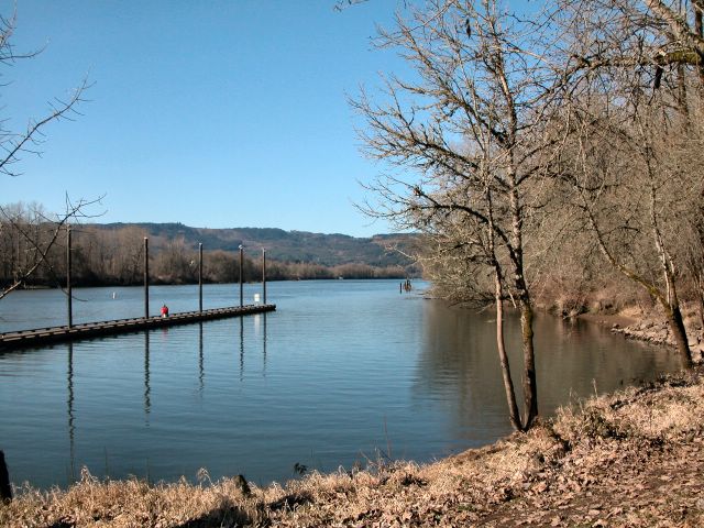
Sunshine in February seems more valuable than in, say, August and that got us out of the house and onto our bikes last Saturday. But really, sunny or rainy, this trail is a great place to get some exercise. Although we were on bikes today, many people were walking the trail.

We've been coming here for years, biking the various sections of the trail as they were completed. Today, we rode from the Manning trailhead northwest to the entrance road of Stub Stewart Park. This section includes crossing the Buxton trestle, an unusual thrill on a bike. We also rode to Banks to check out the new trailhead there, a big improvement from the abrupt end to the trail formerly in place.

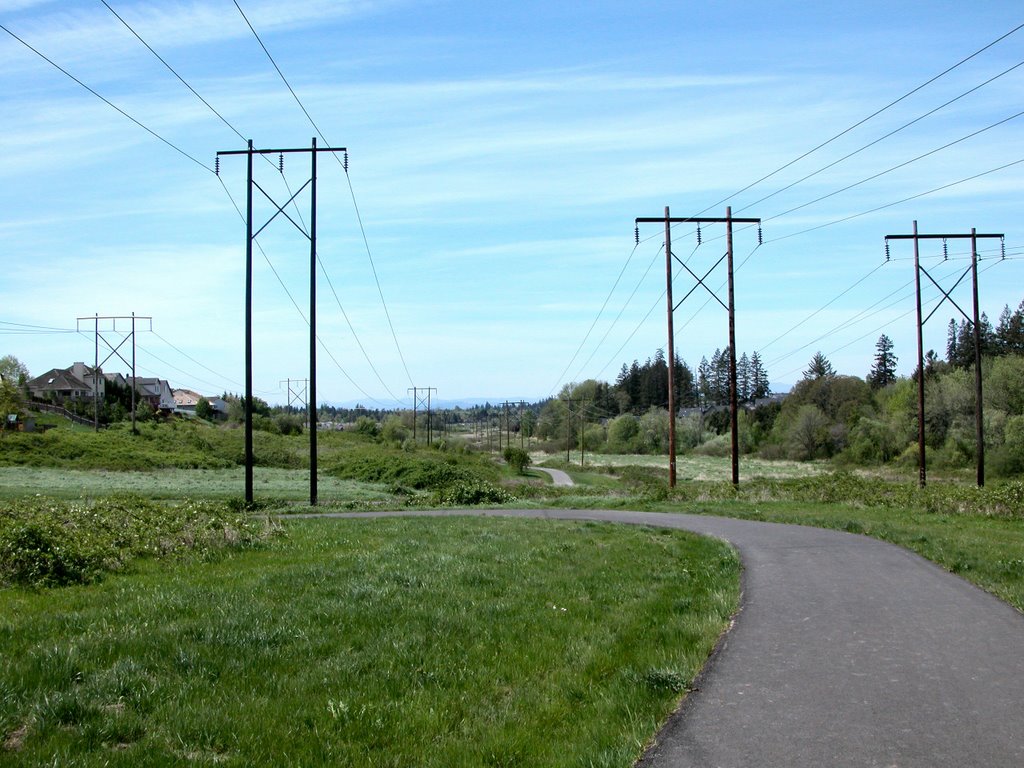
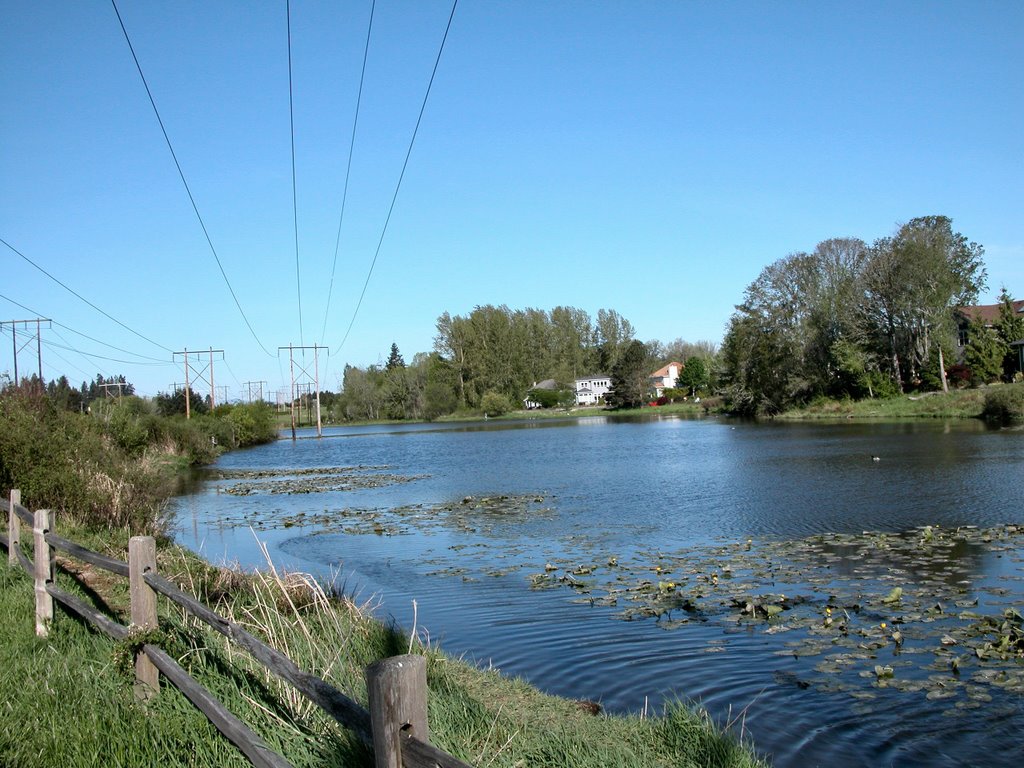
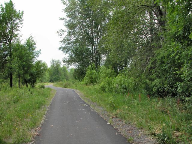
From Banks, the trail has little elevation change, which continues as you pass the Manning trailhead. At about mile 5, the trail becomes a gentle but steady climb which doesn't quit as far as we rode. The surroundings likewise change from pasture to woods. We stopped several times to enjoy the scenery and the climb kept us warm in spite of a trail side skiff of snow in some shady spots.

We'll be checking out other sections of the trail in the future to see what changes have been made since our last visits to those sections several years ago.

Wednesday, November 17, 2010

NW ~ Wildwood Trail from Germantown Rd Loop


Date visited: November 8, 2010
Agency: City of Portland Parks and Recreation
Path Surface: Dirt and mud
Elevation gain/loss: 300 feet
Distance: Variable, we went about 5 miles
Ratings: Setting ++++ Calorie-burning ++++
Directions:Germantown Road is between US Highway (the road to St Helens) and Skyline Boulevard. The Wildwood Trail parking is at N 45 35.236, W 122 47.640. The slightly larger parking lot at Leif Erickson Drive is at N 45 35.345, W 122 47.423.

We started out with the hike described in Afoot & Afield Portland/Vancouver: A Comprehensive Hiking Guide and titled Northern Forest Park Loop. This involves walking generally southbound on the Wildwood Trail for about 2 miles to the (unmarked) Springville Road, turning left and returning north on Leif Erickson Dr. The latter two "roads" are closed, but you will recognize Springville Road because it is a wider "trail" than the other places you can drop down to Leif Erickson.

On our hike today, huge golden leaves from the maples zig zagged through the air giving up to gravity and the season. Leaves lined the trails and have already turned to trail mush in the middle of the path.

We chose to go on another quarter mile or so to the Hardesty Trail to form the bottom of our loop. Also, while the book describes a walk back to your car on Germantown Rd, there is now a trail, the Cannon Trail from Leif Erickson back up to the Wildwood trailhead. A map is available here, although it does not show the new Cannon Trail, which parallels Germantown Rd.

If you want to see pileated woodpeckers, this is prime territory. Not far into the hike we heard two, sounding like native tribes signaling each other. Woodpecker sign was all around us. When we had dropped down to Leif Erickson Dr, we finally saw one: the large wingbeats caught my attention. Many other forest birds were active throughout our walk today.

Next time, I think we will start on Leif Erickson. A bigger parking lot and we'll end with a downhill walk instead of a final uphill ascent to the car!

Monday, June 08, 2009

NW ~ Rock Creek Nature Preserve


Date visited: June 8, 2009
Agency: PCC Rock Creek
Path Surface: Dirt
Elevation gain/loss: 40 feet
Distance: If you try hard you might be able to get 2 1/2 miles
Ratings: Setting +++ Calorie-burning ++
Directions: From Hwy 26, take exit 64, go north on 185th and turn right on Springhill Rd, follow signs to Rock Creek PCC campus. To generate the most mileage. park in lot B.

I wish there were more trail and I wish what trail there is was better maintained, because this really is a pretty place in spring and summer. Consider visiting on the weekend when the $3 parking fee does not apply.

To maximize mileage, park in lot B and cross campus to the northwest corner, near Building 3. We walked the north edge, where we saw several barn swallows and a few nests clinging to the buildings. A gate near the northwest corner of Building 3 is the beginning of the dirt trail that leads downhill through mixed woods and wildflowers. At another gate, cross an old farm road and go through yet another gate. Continue downhill through the woods to a fork in the trail. The left fork quickly ends at a meadow. The right fork continues to a boardwalk which also leads out into the meadow, about .3 mile from the first gate.

Entering this new habitat, look and listen for white breasted nuthatches, which are nearly as apt as acorns to be on the big oak trees. Swallows cruise and dart over the grassy meadow. Common yellowthroat "witchety-witchety" nearby, but mostly out of sight. We are too late for the camas display, but I can imagine it was fantastic.

The boardwalk ends abruptly at a locked gate, only a tenth of a mile after you enter the meadow. On our return, we walked the farm road past the gates and trail and were rewarded with great views of a lazuli bunting. We then backtracked to the gates, took the right hand one following the trail back uphill, to and across the developed campus to lot B. Our bird species count for the day was 31.

There is allegedly a 1/2 mile paved trail near parking lot B, but today at least, the entrance was chained shut. An aerial photo of the site is located here.

Thursday, May 28, 2009

NW ~ Salmon Creek Greenway


Date visited: March 27, 2009
Agency: Clark County, City of Vancouver
Path Surface: Paved
Elevation gain/loss: a few rises of about 10 feet
Distance: Six miles total-out and back
Ratings: Setting +++ Calorie-burning ++++
Directions: From I-5 take exit 5 in Vancouver, go east on 99th St, then turn north .9 mile on Hwy 99. Finally, go west .3 mile on 117th to the trailhead within Salmon Creek Park (on the right).

This nicely paved path makes for an enjoyable spring walk or bike ride. If you decide to do it on a hot day, take some water—there's almost no shade.

At the beginning, the path clings to Salmon Creek's south bank. After passing the noise and commotion of the ball fields, the path curls around to a more natural path-side setting on both sides, but eventually moves away from the creek. Although there's little shade on the path itself, there's plenty of brush and woods for wildlife. On our walk today, we spotted 21 species of birds, including one merrily singing ruby crowned kinglet, and one rabbit. Wildflowers were just beginning to bloom in the woods past the T-intersection.

Mileage is marked in the asphalt. Near the last half mile of trail, the path widens, overlooking seasonal ponds, where winter and early spring waterfowl paddle about. As the weather warms, both the water and the waterfowl will disappear, to return with the fall rains.


Click here for a map.

Monday, March 16, 2009

NW ~ Wildwood-Springville Rd South


Date visited: March 6, 2009
Agency: City of Portland
Path Surface: Mud right now, dirt eventually
Elevation gain/loss: 360 feet
Distance: 5 mile loop, as described
Ratings: Setting ++++ Calorie-burning +++
Directions: On Skyline Blvd northeast of Portland city center, drive .9 mile south from the Germantown Rd intersection or 3.9 miles north of Cornell Rd., turn east on gravel Springville Rd. (pass the first Springville Rd sign when coming from the south). Follow this short section of Springville Rd to the trailhead.

Right out of the car we spotted a pileated woodpecker 50 yards away from the parking lot. Bird activity is normally hottest in the morning, but if you just want a nice quiet walk in the woods, this is a good option any time of day.

From the parking lot, start out on Firelane 7, then veer left (downhill) at the first intersection on a long-closed section of Springville Road. After a bit more than .3 mile, turn right on the Wildwood Trail.

The distant sounds of industry mix with the notes of chestnut backed chickadees, winter wrens and towhees. We spotted a varied thrush here mixing with a few robins and had a good look at a downy woodpecker. Red breasted nuthatches nyah-nyah-nyah from the trees. Red catkins dangling from the alders and tiny, vivid-green leaf shoots from the osoberry (Oemleria cerasiformis) herald spring.

The trail, nearly level for 4.3 miles, passes intersections with the Hardesty Trail, Ridge Trail, Firelane 7/Gas Line Rd, and Oil Line Rd. After mile marker 18 ¾ (look on the trees marked with a blue diamond), walk over two wooden bridges. Immediately before the third bridge, turn uphill on the unmarked Trillium Trail on the right. Climb steeply .25 miles, then turn left on Firelane 7. Follow the Firelane back to your car.

Find a rough map here.
Thanks to Doug Lorain for describing this hike. Afoot & Afield Portland/Vancouver: A Comprehensive Hiking Guide

Tuesday, January 06, 2009

NW ~ Rock Creek Trail


Date visited: January 6, 2009
Agency: City of Hillsboro, Tualatin Hills Parks and Recreation
Path Surface: Paved, boardwalk, one short dirt trail detour
Elevation gain/loss: Rolling hills about 20 feet elevation differential
Distance: 3.7 miles
Ratings: Setting +++ Calorie-burning +++
Directions: Parking lot at Orchard Park, 20900 NW Amberwood Dr. in Hillsboro. From the Sunset Highway (US Hwy 26), exit at 185th southbound. Turn right on Cornell Rd, left on 206th and right on Amberwood. Look for the sign for the park.
Notes: Street crossings can be dangerous. If you are with slow walkers, consider using crosswalks at nearby intersections. It was apparent that some of the path had been flooded with our recent precipitation, so be alert for trail closures in heavy rain. I did some looking around for information about the people whose grave markers are in the park, including a visit to the Washington County Historical Society. If anyone has information about these folks (or why they are buried there), please leave a comment!

This loop through the park and path along Rock Creek is one of the designated “regional trails,” that will eventually connect the Beaverton Powerline Trail and Rood Bridge Park. The bonus here is the chance to get a look at several common westside Oregon birds, who hang around because of the water and wetlands of the creek.

From the parking lot in Orchard Park, walk south along the wide paved path also suitable for biking. Take the first left downhill to the bridge over Rock Creek. At the next intersection, keep left. This short detour turned up lots of kinglets, chickadees and a pretty Townsend's warbler. When you reach the rock circle, take a left on the dirt trail. After traveling .1 mile, keep watch to the right for the grave marker for Brian and Irene Burt.

Return to the main path, turn left on the boardwalk, recross the creek and continue around the loop back toward the parking lot. Follow the sidewalk in front of the restroom to Amberwood Dr, turn right, cross the bridge over the creek and look for the paved path on the other side of Amberwood.

At the end of this short segment (which was today full of robins), turn left on Cornell Rd. to find the continuation of the path. Continue to follow the main path on a boardwalk over a grassy marsh. Birds hang out in the trees all along this section, and if you are lucky, you might spot a kingfisher darting along the creek, as we did today. Be especially vigilant at some feeders to the right behind an apartment building, where we saw a whole crew of pine siskins enjoying the nyjer thistle.

One more street crossing at Evergreen Parkway, then under the freeway and you reach the current end of the path after traveling about 1.3 miles from Orchard Park.

Bird species count for today's trip: 21

Wednesday, March 19, 2008

NW to NE ~ Burnt Bridge Creek Trail-Current Full Length


Date visited: October 29, 2007
Agency: City of Vancouver
Path Surface: Paved
Elevation gain/loss: Definitely some up and down but elevation gain from end to end is minimal
Distance: 7.6 miles one way
Ratings: Setting +++ Calorie-burning ++++
Directions: I-5 to 78th St. in Vancouver. Turn west 1.3 miles to Fruit Valley Rd. (Sign says Lakeshore Rd.) Turn left .4 mile, turn left onto Bernie Dr and immediately turn left into small gravel parking lot.

The completion of more sections to this path create a nice streamside venture out Burnt Bridge Creek, a long walk without a shuttle or a very pleasant bike ride. Expect some hills.

Begin at Stewarts Glen, the most woodsy and perhaps nicest section of the trail. A serene ponded area is a waterfowl haven. Enjoy the gentle roll of the path, a warm-up for some bigger hills ahead. Alder and oak stand by.

At .5 mile, cedars and doug fir crowd in. At .7 mile, the path emerges from the trees and meanders through the reed canary grass to meet up with the creek. Look for an old pear orchard. After crossing two more streets, the path appears to end, but turn right on Hazel Dell Ave, look for the continuation on the east side of the road at about .2 mile farther.

Cross the freeway on the overpass and follow the signs for the Discovery Trail. When you reach Leverich Park Way, turn uphill to the right and look for the “Greenway Access” sign on the left. Breeze through grassy Leverich Park by ignoring all turns until the path curves over the creek, then take the 1st left. Go uphill to cross over the road to 41st Circle where you turn right, go to the end of the road and find the path again. At St Johns Rd-about halfway at 3.6 miles-turn right up hill to cross at the crosswalk.

The path then hurtles down to the creek which means another climb back up to pass through a large meadow under the powerlines. Continue on the path, reaching the Devine Trailhead. Our favorite detours from the main path begin .5 mile from this trailhead, just after the asphalt turns to pavers and concrete. Turn left to take the west pond loop, where for a delightful glimpse of winter waterfowl.

As you loop around, you will return to the main path and a crosswalk to continue on. The first left intersection is the east pond loop, with a nice viewing area. Again, the loop returns to the main path, where a left turn brings you along under a bluff to the current end of the path in a nice park at Burton Rd. Map.

Saturday, January 19, 2008

NW ~ Vancouver Lake to Frenchmans Bar


Date visited: January 16, 2007
Agency: City of Vancouver
Path Surface: Paved, 12 feet wide
Elevation gain/loss: None
Distance: Variable, but up to 7.4 miles on paved path or more on trails
Ratings: Setting +++ Calorie-burning ++++
Directions: From I-5, take the Fourth Plain exit and follow it west until it turns into Lower River Rd. To reach Vancouver Lake Park, at a fork, stay right traveling a short distance on Reiger Hwy. To reach the other access points, bear left at the fork.

Two parks, two bodies of water and copious bird life: this is a great trail for walking or biking with several access points to pick just the distance you want to travel.

Vancouver Lake is at the east end of the path and you can begin your trip at this end by entering Vancouver Lake Park off Reiger Hwy. Park as far north as possible in the park and look for the paved path between you and the lake. Walk to the north end, then turn south with views of the lake to your left. From here, follow the path until you turn west, cross the highway and continue west, first along side an open field, where sparrows and great blue heron hang out. After crossing Lower River Rd., the path travels along a slough, where waterfowl skid across the water.

After 1.8 miles, you reach another access point at Blurock Landing. A small parking area here makes this a possible start for a shorter walk to either Vancouver Lake or Frenchmans Bar Park. As you round the corner after passing the parking area, be sure to veer left to take a look at the viewpoint and interpretive sign.

Continuing on the main path northward, your route takes you between the road and another field 1.4 miles to Frenchmans Bar Park. In the park, the trail rises slightly to a view of the Columbia River and Sauvie Island on the opposite shore. Continue following the paved trail south to a viewpoint where you can learn about the Frenchman for whom this park was named. Return to your start point, enjoying the flyby of the many birds along the way.

If you want to tack on just a bit more mileage, two unpaved trails, one in either park, can add just about a mile and a half to your route. See map.

Note for bicyclists: Lower River Road is nearly level and has wide shoulders for some additional mileage out to this path.

Wednesday, May 09, 2007

NW ~ Sauvie Island Lighthouse


Date visited: March 23, 2007
Agency: Oregon Department of Fish &Wildlife
Path Surface: Dirt and grassy dirt (sneakers will be soaked if rainy or dewy)
Elevation gain/loss: none
Distance: 6.6 miles
Ratings: Setting ++++ Calorie-burning +++
Directions: From Hwy 30, cross the Sauvie Island Bridge, turn north on Sauvie Island Rd. for 1.8 miles to Reeder Rd., turn right and follow Reeder Rd almost 13 miles to its end. The final 2 miles is over gravel. An ODFW permit is required to park, available at Sam's Grocery, just north of the Sauvie Island Bridge.

Mountain views, wildlife and river traffic are the highlights of the easy trail on the east edge of Sauvie Island. And a very pleasant drive to reach the trailhead as well, where you can see double-crested cormorants perched on the pilings and kestrels hanging out on the power lines.

To reach the trail, step over the fence into a cow pasture, then follow a faint double track toward a fence on the north side of the pasture. You may spot a killdeer in this pasture as we did. Go through the silver pedestrian gate and continue to follow the double track, noting the views of Mt St Helens and Hood. At .4 mile, at the bright orange channel marker, veer right off the road onto a dirt path. You can also start out walking the beach, then join the trail.

Continue on the main path, although several faint tracks lead off to the left. You may hear a frog chorus at Henrici Lake, which is barely visible through the thick deciduous forest. Look for song sparrows, Bewick's wrens, towhees, chickadees, kinglets, yellow-rumped warblers, mourning doves and juncos. Search the sky occasionally for great blue herons and bald eagles. Indian plum and elderberry are leafing out, and stinging nettle is ubiquitous.

At the one mile mark, a wide left fork brings you closer to the lake view. Today, six tundra swans took to the air as we walked by. Common mergansers favor this area and we also spotted geese and American widgeons. We heard at least one marsh wren near the lake, while winter wrens are also still singing. This detour rejoins the main path at 1.25 miles.

Kingfishers rattle overhead and the bushtits have paired off for the season. We were able to spot a mossy looking sack where two are nesting.

After 3.2 miles you emerge from the woods onto the beach with a great view of the Warrior Rock lighthouse. If you are interested in reaching the tip of the island, continue north along the beach for a half mile where you can see across to the city of St Helens.

Wednesday, January 31, 2007

NW ~ Ridgefield National Wildlife Refuge


Date visited: January 26, 2007
Agency: US Fish and Wildlife
Path Surface: Dirt/Gravel
Elevation gain/loss: Rolling, short hills
Distance: Two miles
Ratings: Setting ++ Calorie-burning ++
Directions: I-5 in Washington to exit 14. Turn west through the town of Ridgefield and turn right on Main St. Left at sign marking Refuge.

The Oaks to Wetlands Trail offers many viewing opportunites. The first you are likely to encounter is the Plankhouse. On their way to the Pacific Ocean, Lewis and Clark stopped in a native village called Cathalpotle (Cath-la-poo-tuhl or Cath-la-poe-tuhl) on November 5, 1805. They counted 14 cedar plankhouses, like the one reproduced here, belonging to the people of the "Quathlapotle nation." Lewis and Clark's company estimated some 900 inhabitants in the native village. To learn more about the Plankhouse, click here.

After leaving the village, Lewis and Clark camped for the night at a "butifull grassy place." As near as can be determined, this site is located on the Refuge. It is known today as Wapato Portage in Carty Lake because it is here that Clark observed the village women portaging their canoes to collect wapato, a large-leafed wetland plant with a starchy tuber. Watch for the sign as you are out on the trail.

The second attraction of the present-day trail is the signage to identify some familiar northwest plants, including wapato. Winter is a fine time to visit if you are a birder, but if you are interested in plants, pick another season so that you can actually distinguish the plants identified by the signage!

Finally, there are the birds. Winter waterfowl love the open water and wetlands surrounding the trail. Perching birds are plentiful and more visible with the leaves off the trees. Even in winter, you may see a surprising variety of avian species.

The passing trains are a distraction. Automatic gates close at posted times. There is a fee to enter, currently $3. The usual federal government passes are accepted. No dogs are allowed.

Wednesday, August 30, 2006

NW/SW Bonus Mileage Between Walks


For pleasant loop connection to the Willow Creek walk from the Tualatin Hills Nature Park, take the Oak Trail from Vine Maple (near the Interpretive Center) to exit the Nature Park. Turn left upon reaching the street to the light. Cross Merlo at the light, turn left and walk Merlo to 170th where you will turn right. Upon reaching Baseline, turn right then follow it left at Jenkins to Waterhouse South Powerline Park. Walk north along the paved trail crossing roads until you reach busy Walker Rd. The path continues on the other side, but you may want to turn right to the light at Schendel to cross. Continue north, connecting with the Willow Creek walk at the Waterhouse Powerlines Park location. Map.
To return to the Nature Park at the finish of the Willow Creek walk, turn left on Schendel, cross 158th to the Tualatin Hills Parks and Recreation complex. Continue east along a road, keeping the Athletic Center and basketball court on your left. As you come near the end of the basketball courts, turn right onto a wide paved trail and after about 20 yards, turn left onto a bark-covered path. Follow this path to Walker Rd, passing several playing fields on your right. Turn left on Walker, cross at the light at Koll Parkway, continuing east on Walker, but on the opposite side of the street. After .1 mile, turn right onto a paved path with three white posts at the entrance. This path takes you through a wetlands area and part of the Nike campus. Upon reaching the road (Jay Street) turn left to Jenkins Rd and then right on Jenkins. At the next light, turn left onto 153rd. Follow this road as it curves to 154th Terrace and turn right. Follow 154th to Millikan, turn right and return back to the Nature Park. Map.

Wednesday, May 24, 2006

NW ~ Deerfield-Bethany Meadows Parks


Date visited: May 5, 2006
Agency: Tualatin Hills Parks & Rec District
Path Surface: Paved
Elevation gain/loss: 60 ft
Distance: 2.6 miles
Ratings: Setting ++ Calorie-burning ++
Directions: From Hwy 26 (the Sunset) take the 185th Ave exit, go 1.1 miles north to West Union and turn right. After .4 mile turn left into Allenbach Acres (177th Ave) and go to the end of the street.

This section of the eventual 3.5 east/west route has less open water than Bethany Lake Park, but a “wilder” feel. Still, the path is in a slim corridor between subdivisions and the houses are plainly visible.

For the full mileage, turn west and walk back to West Union, where the path will eventually connect through to Bethany Lake. Take the side trail over a wooden foot bridge, where you can see lupine, English daisies and creeping buttercup. These two detours add .6 mile to your trip.

This is prime common yellowthroat country and be sure to look for the American goldfinches, especially at the feeders behind the houses. Swallows go sweeping by and you may see Bewick’s wrens, mourning doves, and house and song sparrows.

At .8 mile, the path splits, giving you the opportunity to go either north or south. For now, continue east past the Pirate Ship playground. After 1.3 miles, you reach the end of this section of the trail in Bethany Meadows Park. Return as you came or explore the short north and south extensions near the playground. If you still want more, return to your car and head west to Bethany Lake Park. (See that post.)

NW ~ Bethany Lake Park


Date visited: May 5, 2006
Agency: Tualatin Hills Parks & Rec District
Path Surface: Paved
Elevation gain/loss: 70 ft
Distance: 2.5 miles
Ratings: Setting ++ Calorie-burning ++
Directions: From Hwy 26 (the Sunset) take the 185th Ave exit, go 1 mile north on 185th to a parking lot on the left.

A small lake, cultivated lawns, fields and a tiny wetlands area provide wide open spaces to stretch your legs. This path is but one section of what is planned to be a 3.5 mile continuous east/west route running under the powerlines.

From the parking lot, the paved path skirts the lake, passing by hopeful fishermen. Mallards and some hybrid geese paddle around on the lily-pad surface. The occasional blue heron stalks its prey. Scrubby brush nearby yields the song of common yellowthroats, while robins, red wing blackbirds, scrub jays and song sparrows also make their presence known. Find a picnic table and a footbridge over Rock Creek after .3 mile. Next to the path here you might see bushtits and
a Bewick’s Wren or two, while tree swallows dart overhead.

The path curves through a diminutive area that is being rehabilitated as wetlands, then gently slopes upward, traveling through a golf course. After 1 mile, you will pass soccer fields on the left where you might see killdeer tottering through the grass. On your right the vegetation harbors towhees, starlings and perhaps a mourning dove. We saw gold crowned sparrows hopping along the path.

The paved path ends at Rock Creek Powerline Park, 1.25 miles from the start. It is possible to cross the street ahead of you and follow a poorly maintained path through the grassy field for .4 mile farther. This path is hard to follow, is often wet in places and simply ends at the freeway. Some wildflowers scattered throughout the field might make this trek worthwhile.

When you turn back toward your car, be sure to notice the view of the West Hills and look for red tail hawks perched on the power line structures. If you are ready for more, an additional section of the Powerlines Park grid is close by, from Deerfield Park to Bethany Meadows Park. (See that post.)

Tuesday, December 27, 2005

NW ~ Stewart Glen


Date visited: December 14, 2005
Agency: Vancouver-Clark Parks and Recreation
Path Surface: Paved
Elevation gain/loss: Gently rolling small hills
Distance: 3 miles round trip
Ratings: Setting ++++ Calorie-burning for Stewart Glen Portion ++
Directions: I-5 to 78th St. in Vancouver. Turn west 1.3 miles to Fruit Valley Rd. (Sign says Lakeshore Rd.) Turn left .4 mile, turn left onto Bernie Dr and immediately turn left into small gravel parking lot.

Take a pleasant walk along a tree-covered hillside overlooking the flood plain of Burnt Bridge Creek. Because of its proximity to Vancouver Lake, many waterfowl drift over to the pond at the beginning of this trail.

From the parking lot, walk down the railroad tie steps to the wide paved trail. Pause to enjoy the pond created by the back-up of Burnt Bridge Creek, where today widgeons, mallards, bufflehead, and gadwalls congregated in the small portion of the pond not covered by a thin sheen of ice. Turn right and enjoy the gentle roll of the path, watching out for some roots that have lifted the asphalt near the beginning of the trail. Alder and oak stand by. Occasional dirt paths shoot off from the main trail, permitting access to the water and to the upper hillside.

At .5 mile, cedars and doug fir crowd in. At .7 mile, the path emerges from the trees and meanders through the reed canary grass to meet up with the creek. Look for an old pear orchard. All too soon, the path ends at Hazel Dell Ave after crossing two other streets.

To continue, however, turn right on Hazel Dell Ave and walk .2 mile farther to pick up the path again on the east side of Hazel Dell Ave. (Look for the yellow posts in the path). This portion of the path will connect you to the Ellen Davis Trail and Discovery Trail on the east side of I-5, with opportunities for many more miles!
Posted by Picasa

Friday, July 01, 2005

N~Smith Bybee Lakes Bicycle Tour


Date last visited: June 21, 2005
Agency: Various
Path Surface: Paved
Elevation gain/loss: minimal
Distance: about 20 miles
Ratings: Setting +++ Calorie-burning +++
Directions: From I-5, take the Portland Blvd. exit (#304), turn west onto Portland Blvd. Follow Portland Blvd. to Willamette Blvd., turn right. Follow N. Willamette Blvd to N. Macrum, turn right, then left on Princeton. Or, from the St. Johns Bridge, turn right on N. Willamette to N. Carey, turn left to N. Princeton.

If you like variety, you'll like this ride through the neighborhoods and wilds of North Portland.

Begin at the southern end of the off-street Peninsula Crossing trail located at the corner of N. Princeton and Carey. Ride one mile slightly downhill through the park-like setting of neighborhood backyards. At Columbia Blvd, turn right, then cross Columbia at the traffic light at Portsmouth. Turn right on Columbia Ct. to pick up the path again. Shortly thereafter, the path splits, but any of the variations soon connect up again to travel through this park area next to the treatment plant that seems to have no name. Continue to the Columbia Slough by way of the pedestrian bridge, then turn left, following the signs to Smith and Bybee Lakes, passing Triangle Lake on your right, then riding parallel to Portland Rd.

At 2.8 miles, continue towards Smith and Bybee, but your route crosses Portland Rd west to an abandoned road. At 3.2 miles, a short gravel trail gives the first close-up of the lakes. At 3.7 miles is a small parking lot with restrooms and interpretative signs. At 3.9 miles, you reach the Jean Washington Interlake trail. No bikes are allowed on this trail, but bike racks are available to lock them up, or walk them along the trail like we did. In around a half mile, you get great views of both lakes and, usually, some wildlife.

Returning to the bike route, continue northeast toward Kelly Point Park on the path next to Marine Drive. At 6.2 miles, a brief detour to the left on a dead-end trail is actually one of the quietest and most pleasant portions of the bike trail and adds a total of 2.6 miles round trip to your route.

After returning from the detour, cross the street to Kelly Point Park Rd. At the end of this road, you can pick up a path overlooking the river. We stopped for a picnic lunch right on the beach and watched the ships and boats ply the Columbia River. Return as you came and your round trip will be close to twenty miles.
Posted by Picasa

Thursday, June 30, 2005

NW~Oak Island


Date last visited: June 20, 2005
Agency: Oregon Department of Fish and Wildlife
Path Surface: Dirt
Elevation gain/loss: None
Distance: 2.9 miles
Ratings: Setting ++++ Calorie-burning ++
Directions: From Highway 30, turn onto the Sauvie Island Bridge. Go north on Sauvie Island Rd. An ODFW permit is required to park and you can pick one up at the little grocery store located a short distance from the bridge. After 1.8 miles, turn right on Reeder Rd., then, after 1.2 miles, left on Oak Island Rd., which turns into a gravel road. Continue forward, cross the dike and look for a "Nature Trail" sign. Park at the gate.

Many areas in the Portland area have a surprising variety of bird life, once you start looking. Close to the city but seemingly miles away, this is one of our favorite places to spot songbirds during the summer and, nearly always, some birds of prey. Bring binoculars and a field guide and you won't be disappointed.

Start out through the white oak forest-there's a reason why this is called Oak Island. We often spend a long time in this first quarter mile because of the abundance of bird life. When the path splits, we generally by force of habit go to the right (east), but it doesn't really matter because you are starting out on a loop.

As you skirt the oaks to the left, be on the lookout for the great horned owl that sits quietly in these trees. Also keep an eye and ear out for our favorite bird of the area, the Bullock's Oriole, which you will often hear chattering in the trees.

The path eventually reaches a view of Sturgeon Lake and Mt. St. Helens, then turns north. Along this stretch of the path we nearly always hear common yellowthroats and occasionally the flap and splash of carp in the lake. Cedar waxwings seem to like this area as well. Deer roam through here and the fields ahead. Bald eagles are becoming much more common-on this day we saw an immature eagle on a large stump about 25 yards away. As you round the corner and turn back south toward your car, the fields open up and remind me of the vast fields of rural Washington County when I was growing up (yes, that was a long time ago!) Posted by Picasa

Saturday, June 11, 2005

NW/SW~Tualatin Paddle Trip


Date last visited: May 27, 2005
Distance: 5 miles one way with shuttle
Ratings: Setting +++ Calorie-burning + + (or more depending on how much you paddle)
Directions: To Rood Bridge Park in Hillsboro, from Farmington Rd. west of Beaverton, turn right on River Road, north 3.4 miles, left on Rood Bridge Rd to Rood Bridge Park. (Rood Bridge Rd. is also 1.1 miles south on River Road from Tualatin Valley Hwy.) GPS N 45.29.39 W 122.57.08. Boat launch is toward south end of park. To take-out point at Harris Bridge: from Farmington Rd and River Rd intersection, drive west one tenth mile to Harris Bridge (the bridge is currently under construction, to reopen in November of 2005). GPS N 45.26.97 W 122.57.06 WARNING: DO NOT ATTEMPT this unless you can get in and out of your boat without being on land. At two places in our route, fallen trees have completely blocked the river at water level and the banks are too steep to portage. We had to crawl out of our kayak onto the logs and drag it over, then hop back in on the other side.

Memorial Day Weekend of 2005 may be remembered by the big tease. Just prior to the weekend, it felt like mid-summer, with temperatures into the 90's, but the weekend was only average (at least it didn't rain). When the temperatures climb, though, it's time to take to the water!

This tree-lined, snaking section of the Tualatin River is perfect for a quick afternoon paddle. We left a bicycle chained to Harris Bridge and drove to Rood Bridge Park to launch. The river is easy to access from the boat launch, although don't wear your best sneakers unless you want to leave them in the mud. Birds twitter and flutter overhead in the trees, with swallows occasionally swooping by. We startled a female wood duck with several chicks and finally had to stop for a few minutes to prevent disturbing them too much as they made their way down river.

The river's current will carry you along at about 1.5 miles an hour without paddling, but if you want some exercise, dip in. This stretch of the river is relatively quiet and you'll see few structures and fewer people. Just after crossing under Harris Bridge, on the east bank, is a wooden rail that will help you out of your boat and up the muddy, slippery shore. The climb back up to road level with your equipment is rough, but doable. Take a look when you set up your shuttle to determine whether it is within your capabilities.

Several other public access points, including some new ones, allow for a longer trip, if you so desire. Posted by Hello

Tuesday, May 10, 2005

N~Columbia Slough


Date last visited: April 22, 2005
Path Surface: Gravel over pavement and paved
Elevation gain/loss: Two short rises
Distance: 5.1 miles
Ratings: Setting++ Calorie-burning+++
Directions: Max Yellow Line to the Kenton/N. Denver Station, near the intersection of N Denver and N Argyle.

For a quickie walk, this trail is not bad, but certainly you can find better spots, even nearby. If you are looking for a bicycle trip of decent lenghth, this may be a good extension for a trip to Smith and Bybee Lakes.

From the Max stop, continue north, parallel to the tracks and cross the N Denver Viaduct. Be careful here, the sidewalk is in poor shape. From the viaduct, you have a good view of the mud-brown water of the slough and the frosted remains of Mt St Helens. Cliff swallows swoop by, feeding and visiting the copious nests attached to the concrete of the elevated Max tracks. Cormorants, herons, geese, wigeon, green wing teal and, of course, mallards may be present.

At the end of the viaduct make a cautious crossing of the street by going to the traffic island at N Schmeer first, then across to the west side of the street north of the guardrail to the trailhead. On one side is the slough, on the other, the Portland International Raceway. Continue west, past Heron Lakes Golf Course and under the railroad overpass at about 2 miles. Turn left onto the pedestrian bridge and follow the trail around to the left through to Columbia Blvd. The trail branches here, and you may decide to wander through this greenspace with whimsical wooden and rock art. Continue right along the trail that parallels Columbia to N Portsmouth so you can use the signal to cross Columbia. Turn left (east). From here, it's exercise, because the scenery is not spectacular, although there is a straight on view of Mt Hood if you can see through the power poles and wires. At the I-5 sign (N Argyle), veer right up a slight hill, past Kenton Park, and back to N. Denver and the Max station. Posted by Hello

Saturday, March 26, 2005

NW ~ Willow Creek


Date last visited: March 18, 2005
Agency: Tualatin Hills Parks and Recreation District
Path Surface: Paved and boardwalk
Elevation gain/loss: minor
Distance: 2.5 miles
Ratings: Setting+++ Calorie-burning ++
Directions: Hwy 26 to the Cornell Rd exit. South on NW 158th .6 mile, right on NW Schendel Ave, which loops around Fred Meyer. Start at 45 31.178N, 122.50.617W

The floral and faunal awakenings of spring surround your walk through several united parks.

Start across the street from the Fred Meyer parking lot (near the garden section), where a wide paved path takes you through the Hunter's Run Apartments. After .1 mile, you come to a T intersection, with the private Jenne Lake directly in front of you. Don't pause here, a much better view of the lake is ahead. Turn left, then veer right next to the RV storage area into Waterhouse Powerlines Park. Continue in a generally northerly direction under the power lines on the path through football-field sized grassy areas-- a great place for kids to burn any excess energy.

At the northwest corner of the Waterhouse Soccer Field, .7 mile, turn left and enter the Willow Creek area, a paved and boardwalk path through a very pretty suburban forest/wetlands area. At 1.2 miles, the path ends at NW 173rd (also a potential starting point). Apollo Ridge Park is directly across the street, but no improved path yet extends through that park.

Return the way you came, but when you reach the soccer field again, continue at its north edge and reenter the woods until you emerge, after 1.8 miles, at the east of the park. Turn right on Waterhouse Ave. and enjoy homes in the area of one of the early "Street of Dreams" home shows. At NW Blueridge Dr. cross the road to another paved path that takes you through the Waterhouse Rose Garden and Waterhouse Park. At the next junction, veer right, pass the picnic area and reach the bridge over Jenne Lake, where you have great view of the waterfowl, who don't seem to mind the 'burbs at all.

After crossing the bridge, continue on to the wide path to your left (near the fountains in the lake) and go back through the apartment complex to your starting point.

Our fowl and fauna list for the day included rabbits, squirrels, red-shafted flickers, chickadees, bushtits, towhees, song sparrows, scrub jays, starlings, a single robin, house sparrows, a ruby crowned kinglet, two white-breasted nuthatch, house finches, a pine siskin, a red-wing blackbird, gold crown sparrows, a fox sparrow, a Bewick's wren, a crow and, on Jenne Lake, American wigeons, Canada geese, mallards and bufflehead. Posted by Hello

Tuesday, March 01, 2005

NW~Virginia Lake


Multnomah Channel
Date last visited: February 15, 2005
Agency: Oregon Parks and Recreation
Path Surface: Dirt, Gravel
Elevation gain/loss: minimal
Distance: 2 miles
Ratings: Setting +++ Calorie-burning ++
Directions: Hwy 30 to Sauvie Island Bridge. North on Sauvie Island Rd. three miles. Parking lot on the left at sign: "Wapato Access Greenway." GPS 45° 39.615N 122° 50.318W


We have always called this walk "Virginia Lake" although, presently, Virginia Pond or Virginia Wetlands would be more accurate. Nevertheless, this walk is a worthwhile two miles, no matter the hydrous content.


From the parking lot, start out on the well-worn and wide path. Shortly, you will arrive at a picnic shelter. From habit, we go left here, although it doesn't matter much, the main trail loops back to this point.

Fifty feet from the shelter is a spur to the right that goes to an immense, grayed viewing platform, overlooking.....no lake. The last several times we have been here, the view is simply an expanse of brown, hissing grass. Someday, in a wetter year, the lake will return along with the waterfowl.

Retrace your steps and continue on the main path, passing by an utterly useless blind on the right. At just over a half a mile, turn left on another spur for a view of the Multnomah Channel from Hadley's Landing. Share the dock with fishermen and gulls or bring a picnic to enjoy next to the river.

Returning to the main trail, turn left to walk beside the river. You know it's there but the vegetation prevents all but an occasional glimpse. Complete the circuit back to the picnic shelter, then turn left back to your car.

A few groups of birds livened up this late winter walk. Both the gold crown and ruby crown kinglets, chickadees, junco, robins, song sparrows and a red-breasted sapsucker made an appearance. Off in the distance, we spotted a bald eagle, which later flew closer to check out the fishing at Hadley's Landing. Also spotted in the neighborhood were a downy woodpecker, a Bewick's wren and a red tail hawk.

Posted by Hello