Date last visited: February 18, 2005
Agency: Tualatin Hills Park & Recreation District
Path Surface: Dirt, gravel, paved
Elevation gain/loss: 50 feet
Distance: 2 miles
Ratings: Setting ++ Calorie-burning ++
Directions: On street parking at the corner of Davies and 135th in Beaverton. Take Hwy 217 to Hall, turn west to Greenway, left on Greenway, right on Davies. Follow Davies (it turns left) to the intersection with 135th. GPS 45.27.622N 122.48.950W
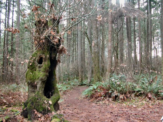
Two parks and a famous tree are the highlights of this forest and suburb trek. Enter Hyland Forest Park at its southeast corner. A maze of trails crisscrosses this woodsy park, but stay on the outer edge trails for a .6 mile loop, enjoying the trees, plants and birds of this island of nature in the "burbs." Before closing the loop altogether, pass by the pond on your right, where mallards occasionally visit, and exit the park. Turn left (north) and take the first right on Rockcress Ct. Walk through the cul-de-sac to the paved path traveling east. This path takes you by Wake Robin Park, in which I have seen considerably more bird life than the plant for which the park is named.
At the end of the paved path, turn north on Sorrento and after .3 mile, veer left onto Hart Rd. After another .1 mile, look for a steel post marked with orange and white reflective tape, indicating another short paved path to the end of another cul-de-sac. On your right, look for the small plaque designating Beaverton's Favorite Tree for 1991. Continue south, turn right on Hanson, crossing to the south side of the street and look for another short path that drops you down to Bayberry St. Turn right on Bayberry, which takes you to 135th, and turn left back to your car.


Great info, great walk!
ReplyDelete